The AA Prepared Routes Service
Forgotten Vehicles & Transport · 1912–2000s
The AA Prepared Routes Service was the Automobile Association’s evolving British journey-planning operation. Introduced with handwritten paper route cards around 1912, it later appeared under names including the Home Routes Service and members’ routes service. Its journey-specific packs could contain written directions, strip maps and town plans, with formats varying by period and route. Home Routes production was computerised internally in 1984, but AA staff still calculated the journeys. Public self-service calculation arrived with the online AA Route Planner in October 1999, and the Bristol postal-processing operation closed shortly afterwards.
Why It Mattered
Its significance lay in turning specialist road knowledge into portable instructions for individual motorists, bridging the gap between general road atlases and web or satellite navigation. The transition from handwritten cards to staff-generated computer itineraries and finally online calculation also shifted control of route planning from specialist compilers to the traveller.
How the Paper Routes Worked
- Before computerisation, a route compiler selected the recommended journey, gathered the necessary stock route sheets and arranged them in travelling order.
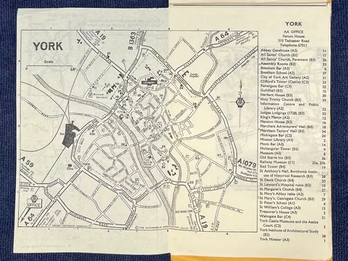
- Depending on the period and journey, packs could include written directions, distances or cumulative mileages, strip maps and fold-out town plans.
- The documents were prepared before travel and followed using roads, junctions, towns, signs, landmarks and mileage; they were not live telephone navigation.
Jane Dallaway’s Surviving AA Route Plan
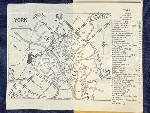
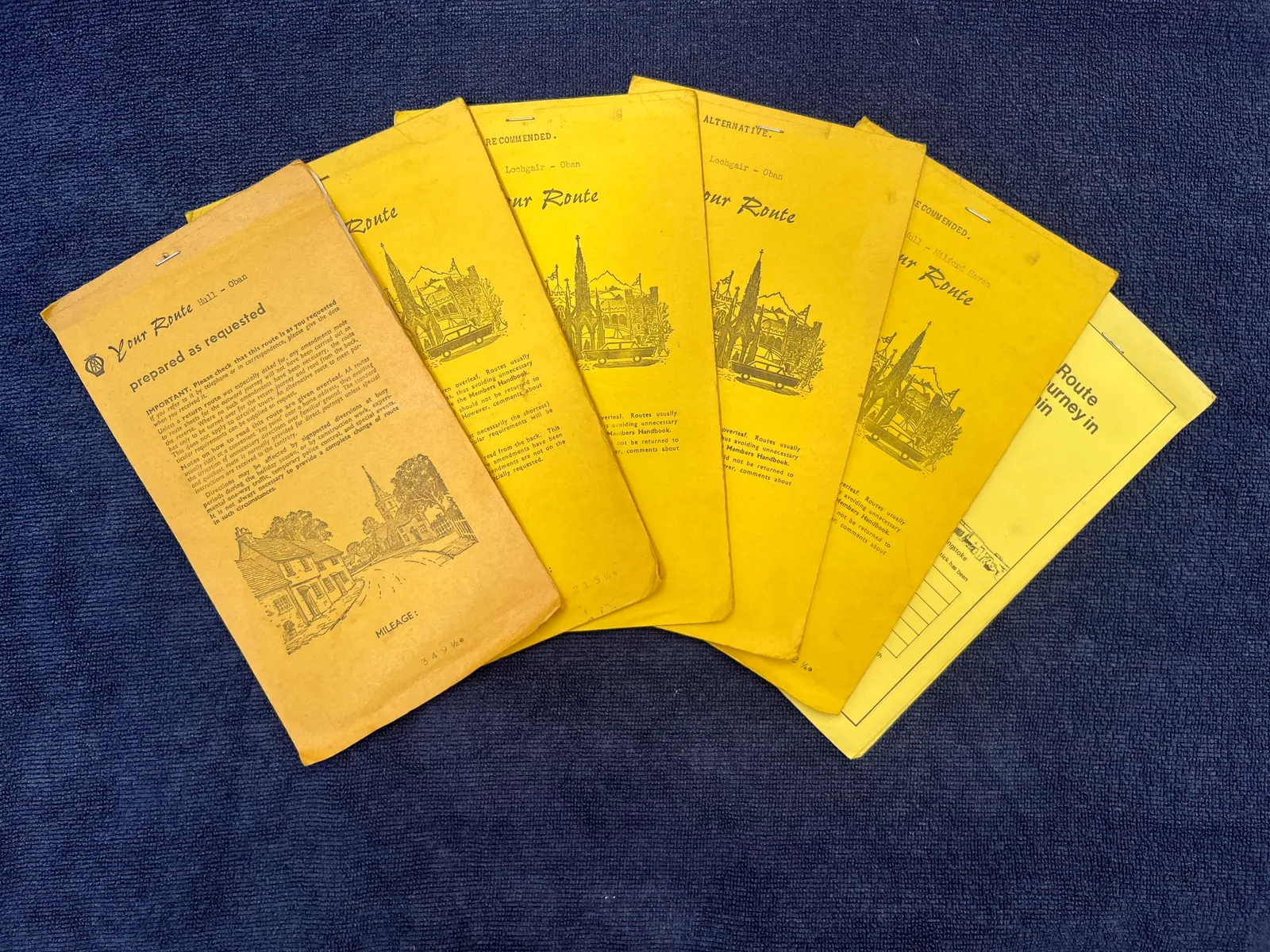
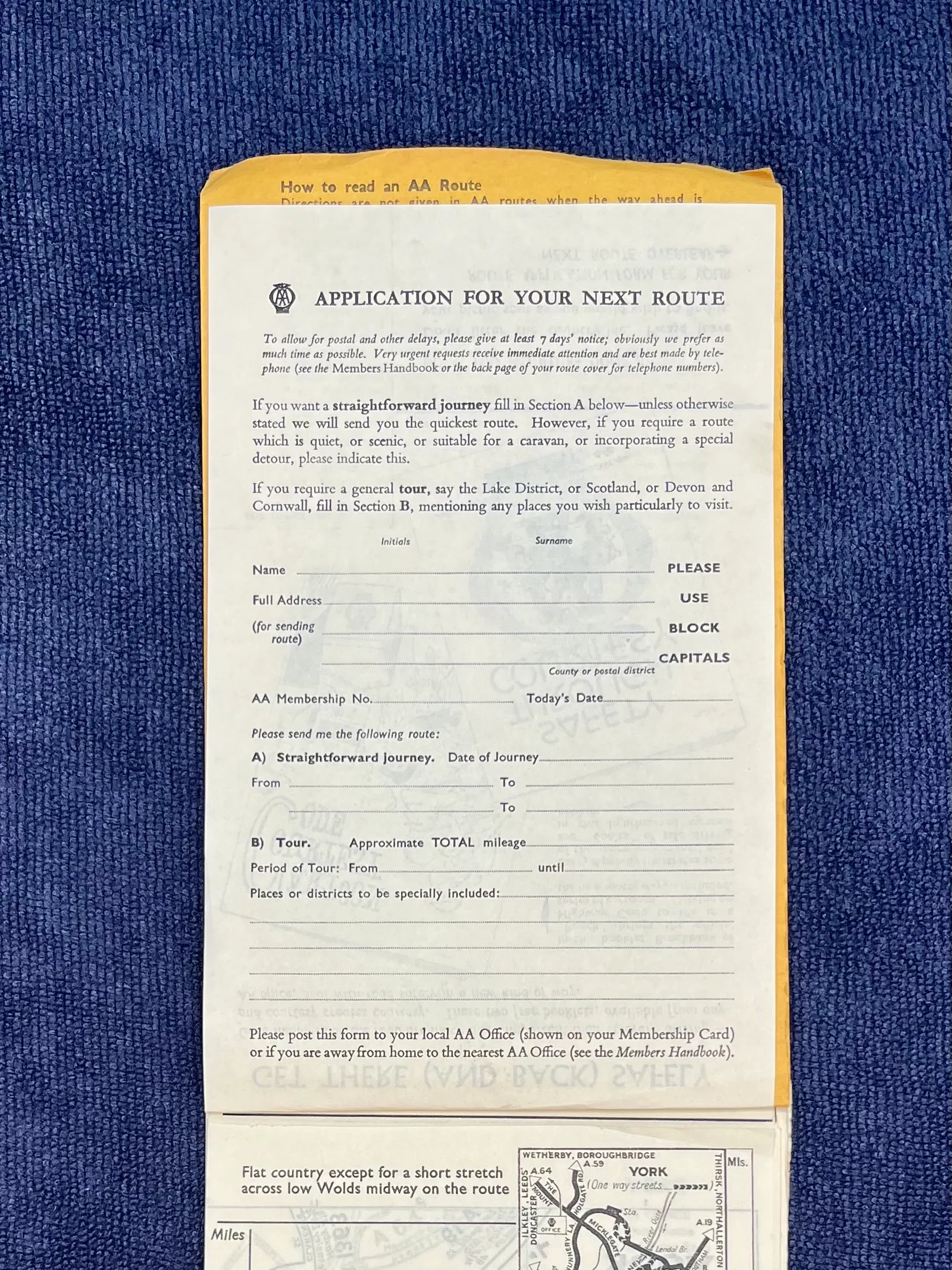
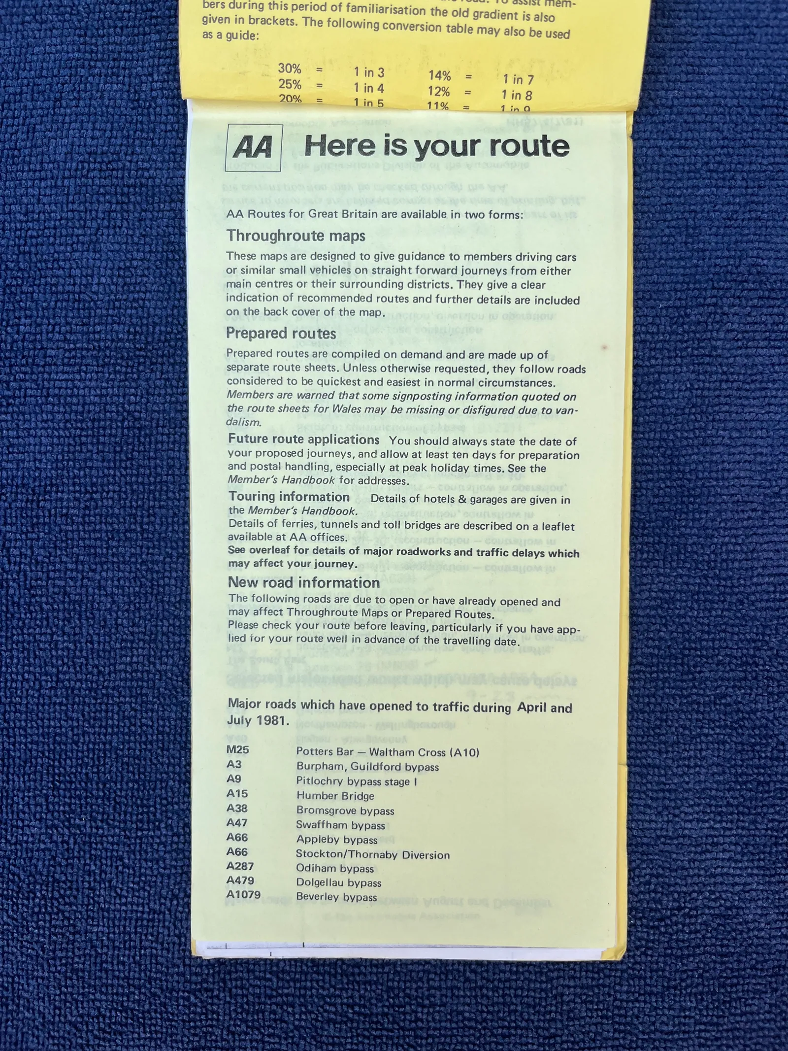
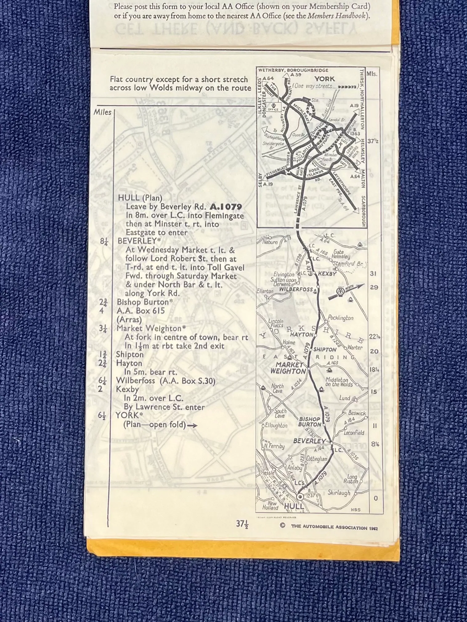
- Jane Dallaway’s firsthand examination and photographs document family-retained route packs containing request paperwork, printed directions, maps and a fold-out York plan.
- A photographed 1960s request form made the quickest route the default while offering scenic, caravan-suitable and touring requests.
- The surviving Hull–York sheet combines written directions with a vertical map for a 37½-mile route and is marked “The Automobile Association 1962”.
From Staff Compilation to Self-Service
- Home Routes became fully computerised in 1984, using an internal database to generate written itineraries on compact fanfold stationery.
- Overseas Routes was computerised in 1987, and the Home and Overseas operations were merged into one Bristol unit in 1990.
- The public AA Route Planner launched in October 1999; the Bristol postal-processing operation closed shortly afterwards, although no precise closure date is given.
Associated With
The Automobile Association - creator and operator
Defining Feature
Journey-specific directions, strip maps and town plans prepared for AA members
Status
Superseded - individually compiled postal routes replaced by online self-service planning
Primary Records
Image Sources
Rights Notice
Images are included for historical and archival reference.
Rights holders may contact Forgotten Archive through the publishing account to request a credit correction or removal.
Gallery and image credits
Jane Dallaway
Permission granted for Forgotten Archive reproduction
View original image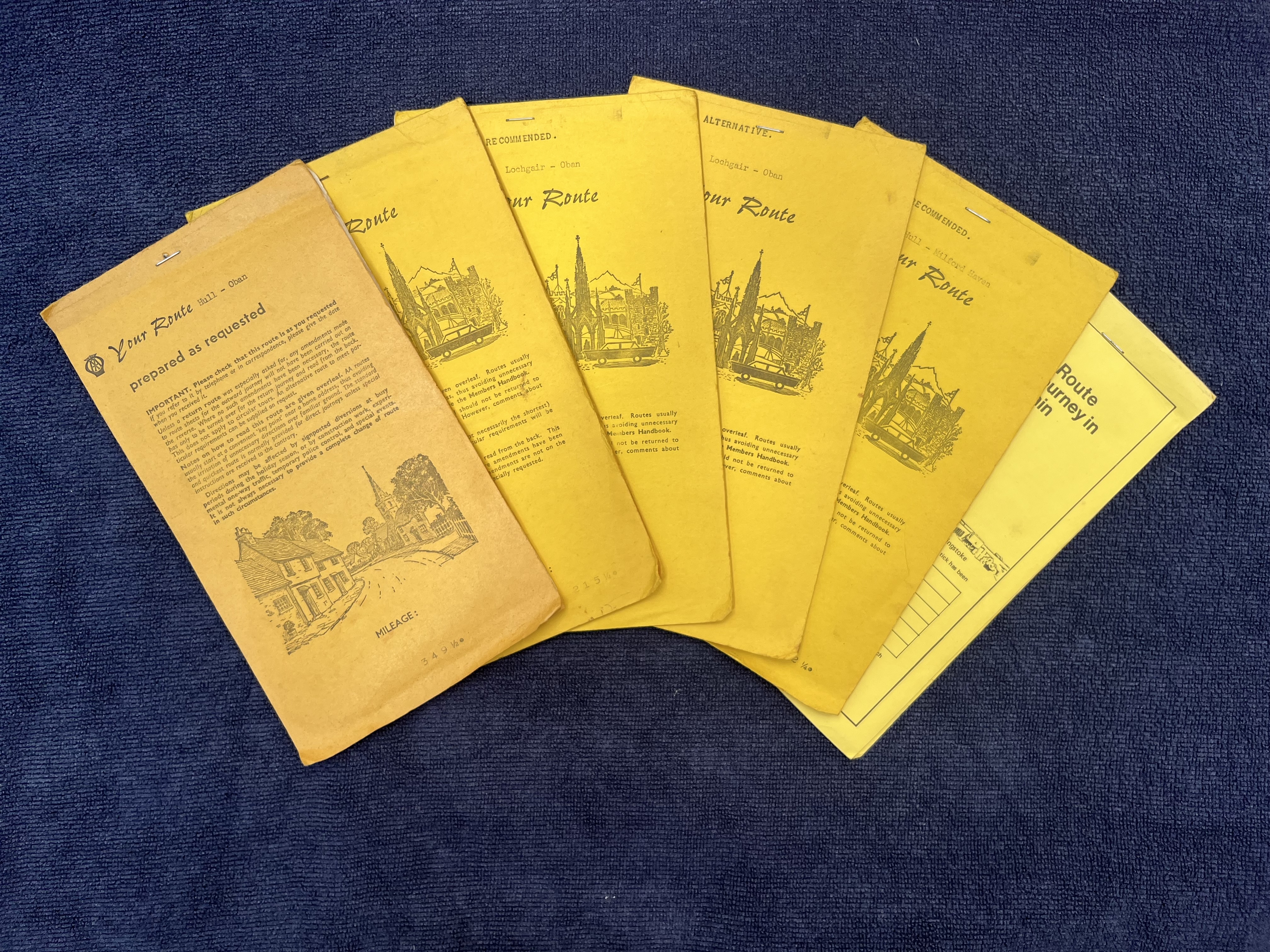
Jane Dallaway
Permission granted for Forgotten Archive reproduction
View original image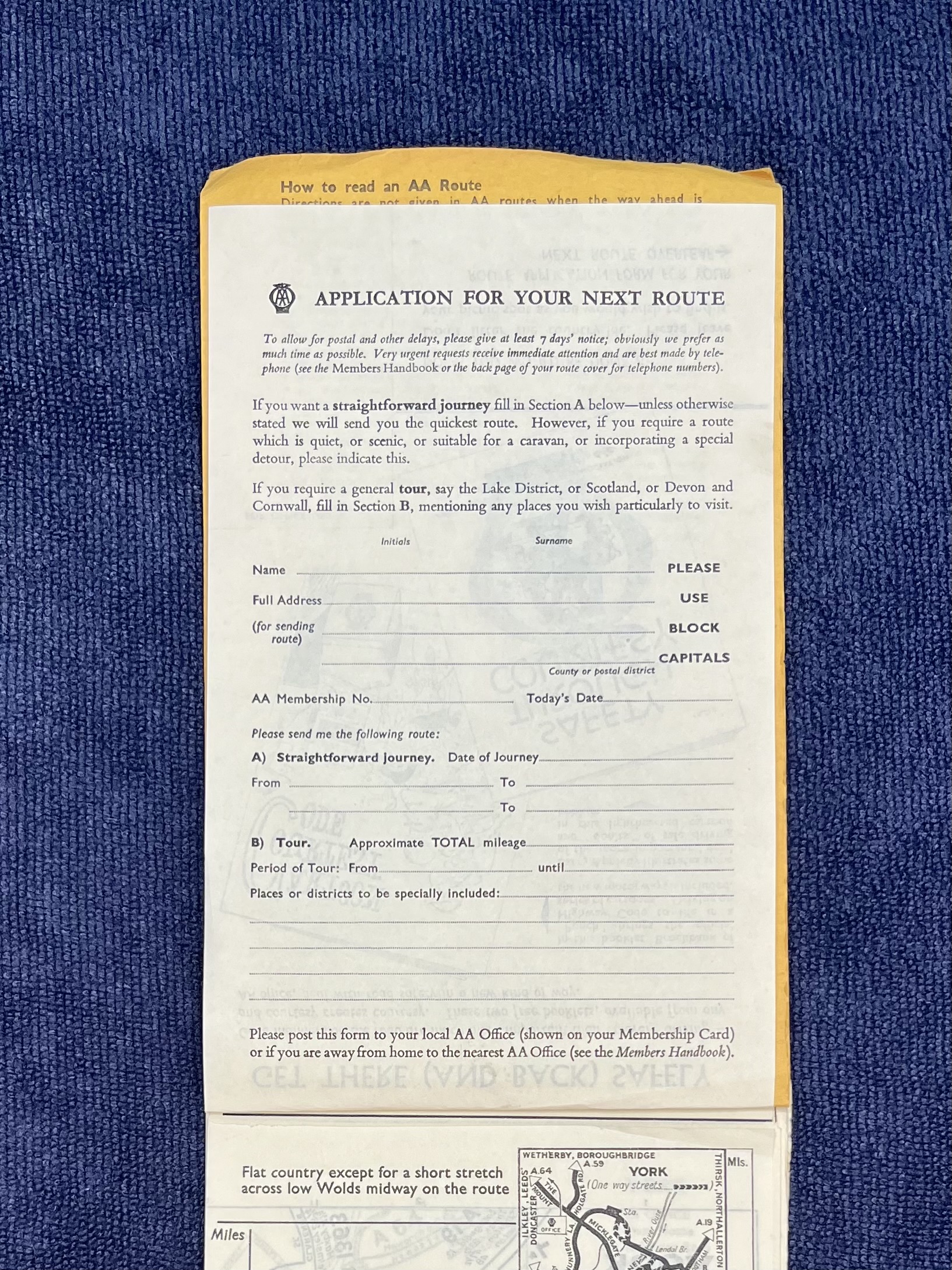
Jane Dallaway
Permission granted for Forgotten Archive reproduction
View original image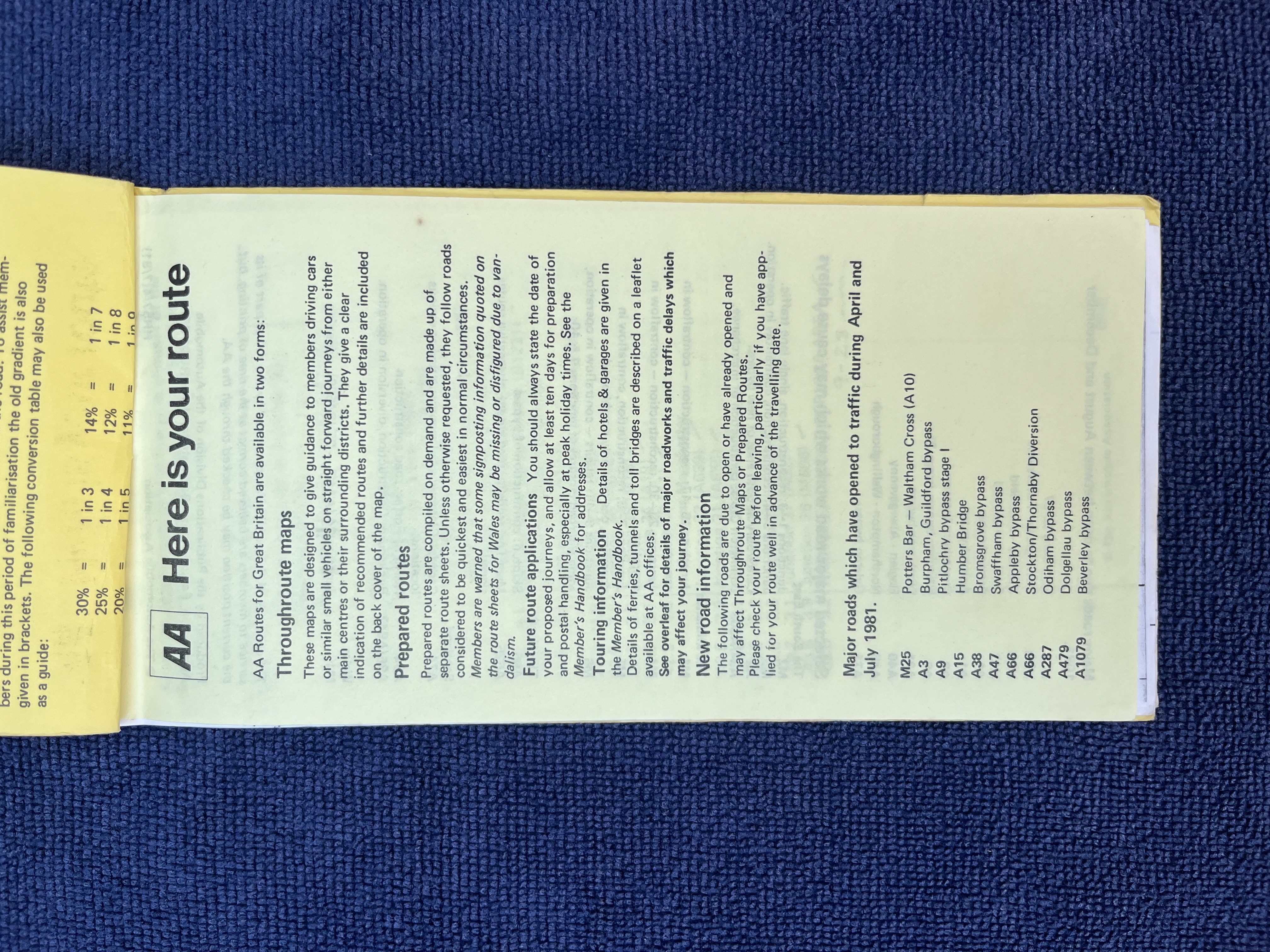
Jane Dallaway
Permission granted for Forgotten Archive reproduction
View original image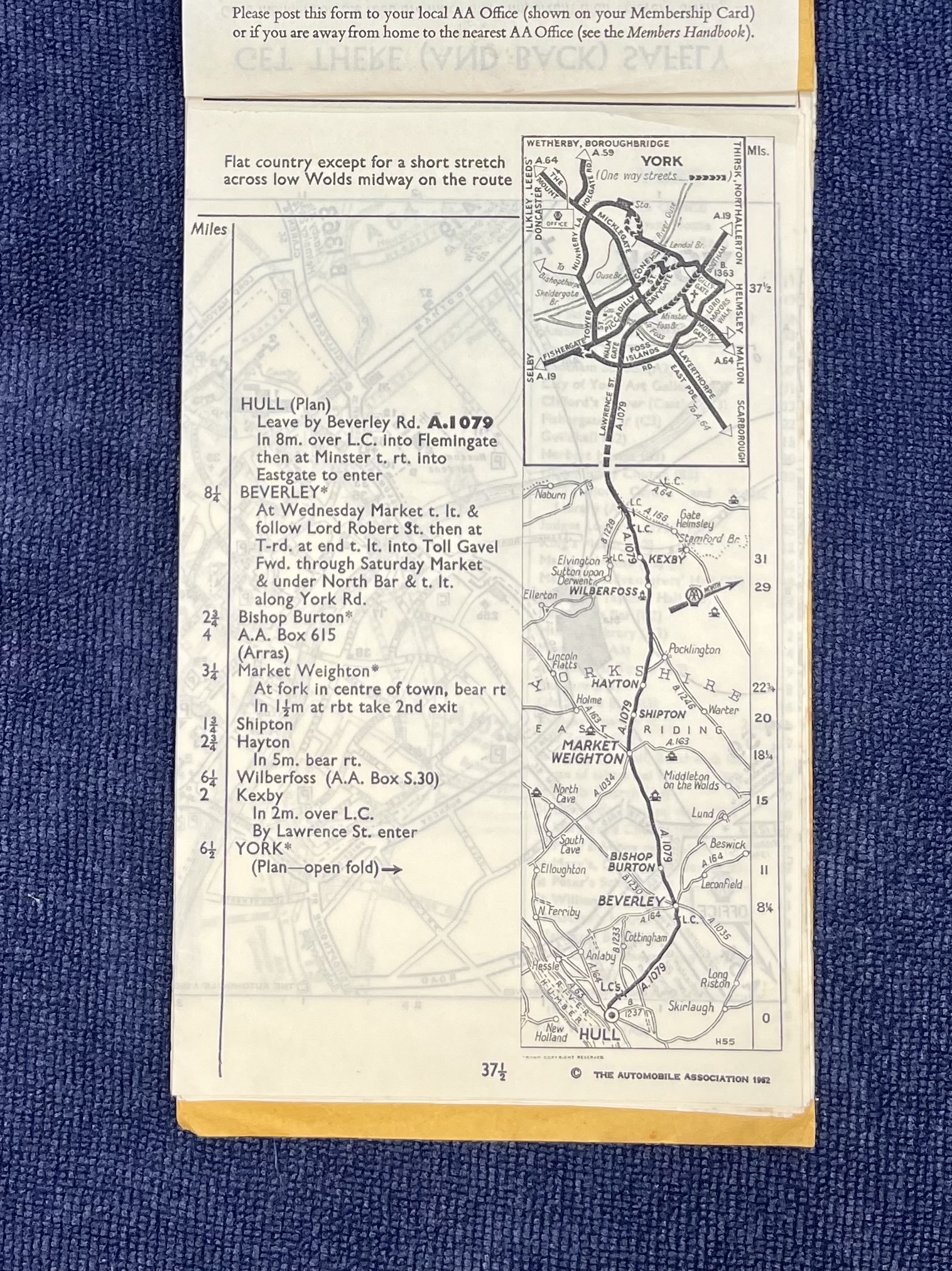
Jane Dallaway
Permission granted for Forgotten Archive reproduction
View original image