The AA Prepared Routes Service
Personalised Paper Directions Before Online Routing
Forgotten Vehicles & Transport · 1912–2000s
Archived on
Associated With
The Automobile Association - creator and operator
Defining Feature
Journey-specific directions, strip maps and town plans prepared for AA members
Status
Superseded - individually compiled postal routes replaced by online self-service planning
Overview
The AA Prepared Routes Service gave British motorists journey-specific directions before online routing.
Introduced with handwritten route cards around 1912, the service later appeared under names including Home Routes Service and members’ routes service. Packs could contain written directions, strip maps and town plans, with formats varying by period and journey.
Home Routes production was computerised internally in 1984, although staff still calculated the journeys. Public self-service calculation arrived with the online AA Route Planner in October 1999.
Why It Mattered
The service turned specialist road knowledge into portable instructions for individual motorists, bridging the gap between general road atlases and web or satellite navigation.
Its development from handwritten cards to staff-generated computer itineraries and online calculation shifted control of route planning from specialist compilers to the traveller.
Preparing the Paper Routes
- Before computerisation, a compiler selected the recommended journey and arranged the necessary stock route sheets in travelling order.
- Depending on the period and journey, packs could include distances, cumulative mileages, strip maps and fold-out town plans.
- Travellers followed roads, junctions, towns, signs, landmarks and mileage rather than receiving live navigation.
A Surviving Hull–York Route Pack
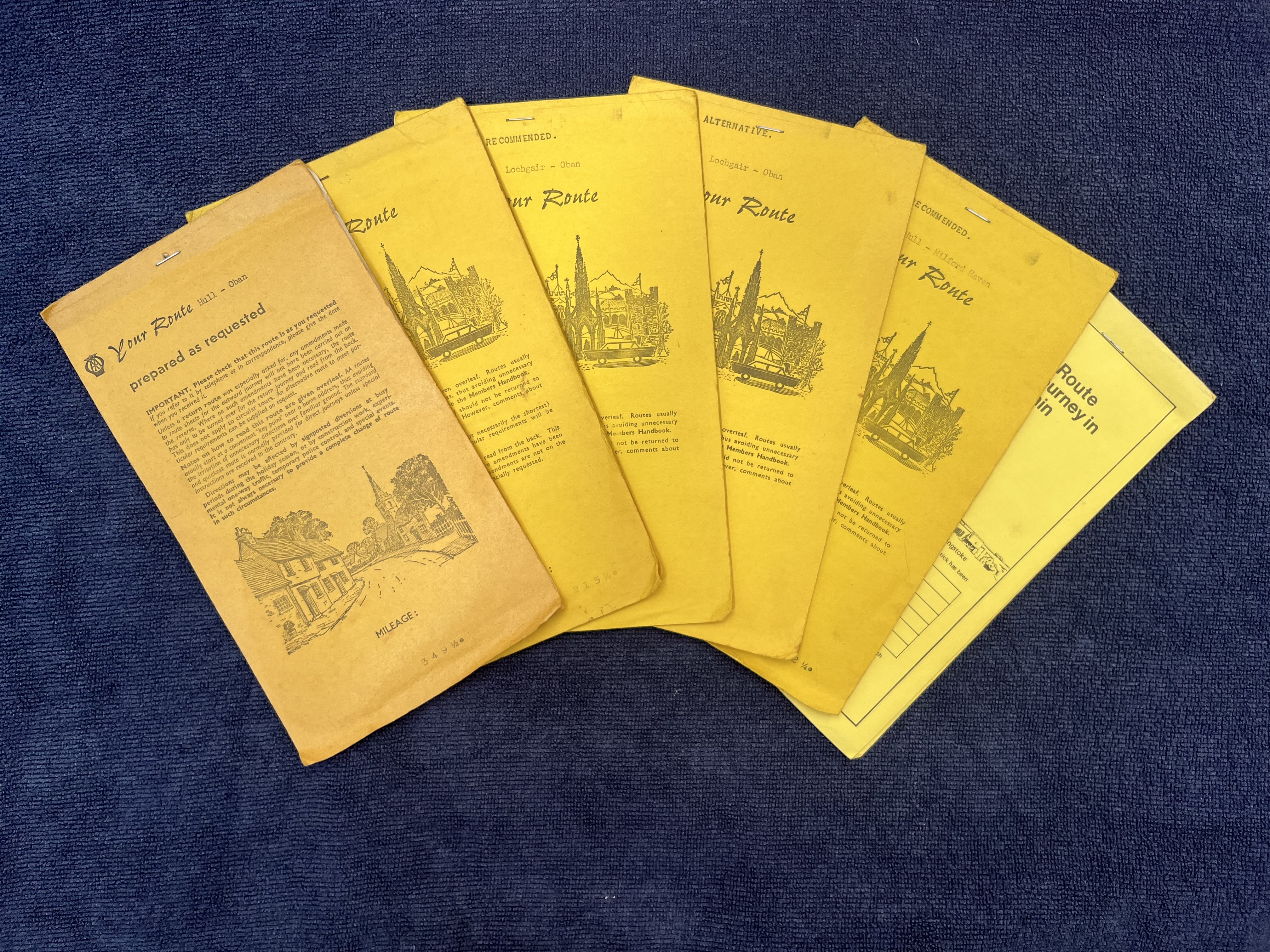
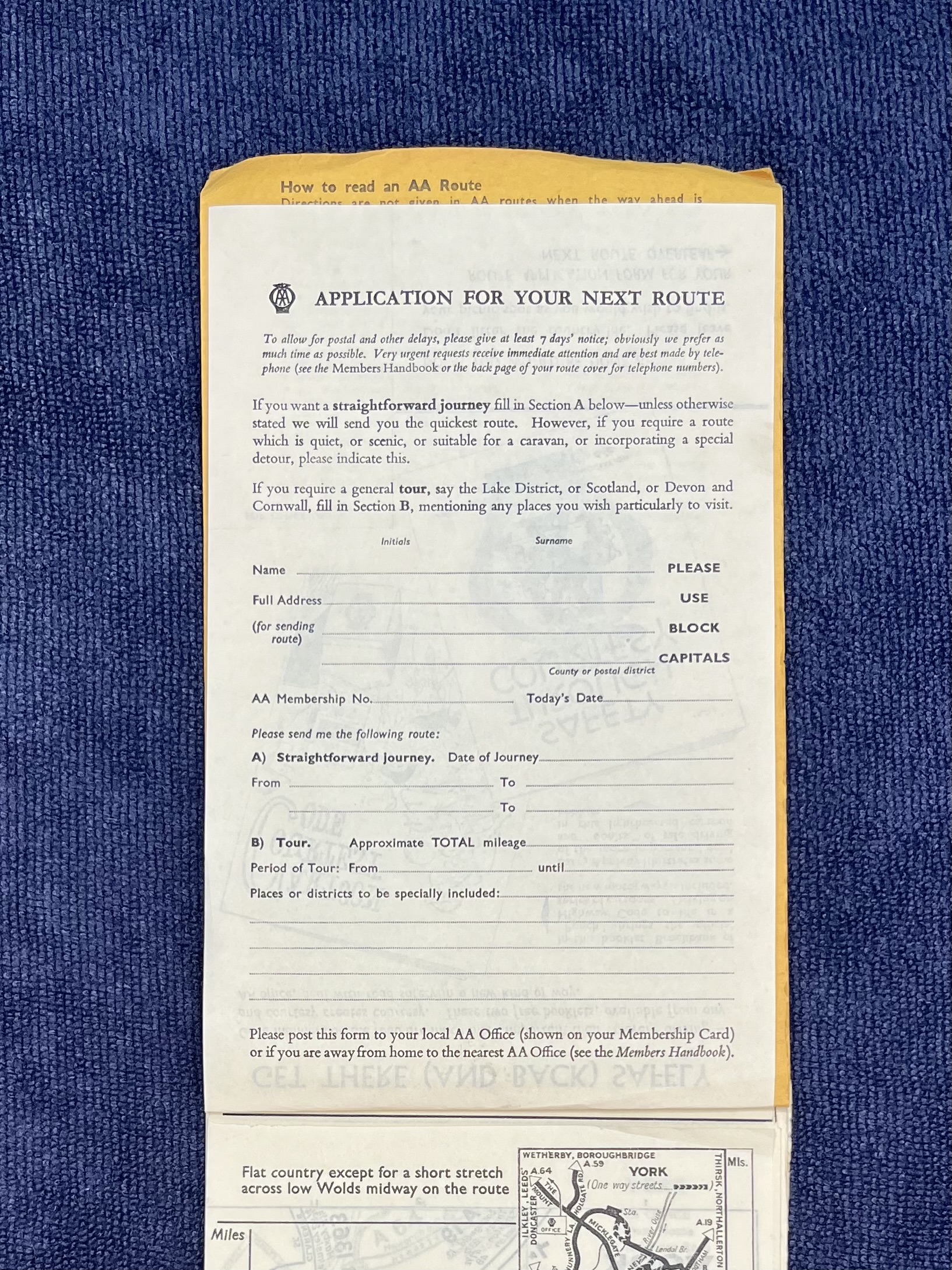
- Family-retained packs contain request paperwork, printed directions, maps and a fold-out York plan.
- A photographed 1960s form made the quickest route the default while offering scenic, caravan-suitable and touring requests.
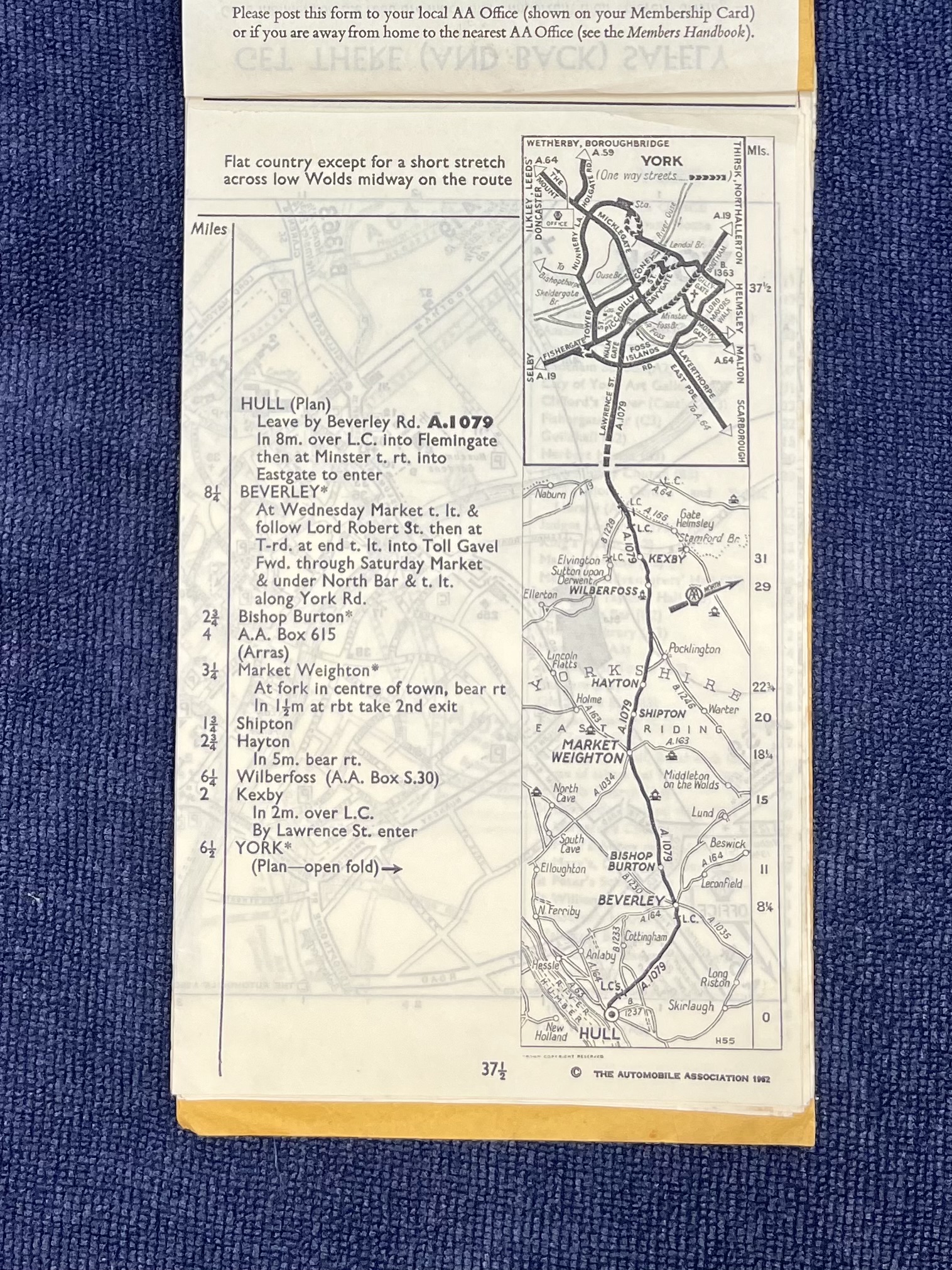
- A Hull–York sheet marked “The Automobile Association 1962” combines written directions with a vertical map for a 37½-mile route.
From Staff Compilation to Self-Service
- Home Routes became fully computerised in 1984, generating written itineraries from an internal database on compact fanfold stationery.
- Overseas Routes was computerised in 1987, and the two operations merged into one Bristol unit in 1990.
- The public AA Route Planner launched in October 1999; the Bristol postal-processing operation closed shortly afterwards.
Sources & Records
- AA history — the development of route planning — Dates the handwritten routes, internal computerisation and October 1999 online launch.
- Developing and providing driver route information systems — Explains how compilers assembled route sheets and how the computerised service changed their output.
- The AA's 120th anniversary history — Corroborates the 1999 online launch and its first million routes.
- AA Route Planner — Provides the present-day successor to the paper route service.
Gallery
Credit
Jane Dallaway
Licence
Permission
Permission was granted for reproduction by Forgotten Archive. This does not grant permission for third-party reuse.
Caption
AA route booklets turned a planned car journey into a portable set of instructions, personalised before digital navigation.
Credit
Jane Dallaway
Licence
Permission
Permission was granted for reproduction by Forgotten Archive. This does not grant permission for third-party reuse.
Caption
The blank AA application form shows the journey details requested from members before a prepared route was produced.
Credit
Jane Dallaway
Licence
Permission
Permission was granted for reproduction by Forgotten Archive. This does not grant permission for third-party reuse.
Caption
The Hull-to-York sheet pairs written directions with a vertical route map, illustrating the format of a surviving 1962 itinerary.